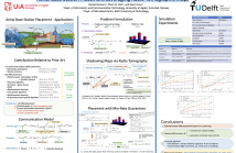
- Read more about Aerial Base Station Placement Leveraging Radio Tomographic Maps
- Log in to post comments
Mobile base stations on board unmanned aerial vehicles (UAVs)
promise to deliver connectivity to those areas where the
terrestrial infrastructure is overloaded, damaged, or absent. A
fundamental problem in this context involves determining a
minimal set of locations in 3D space where such aerial base
stations (ABSs) must be deployed to provide coverage to a set of
users. While nearly all existing approaches rely on average
characterizations of the propagation medium, this work
- Categories:
 32 Views